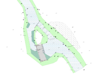
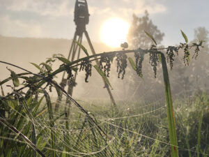
Minimum Flow Assessment in Mavrovo National Park, North Macedonia
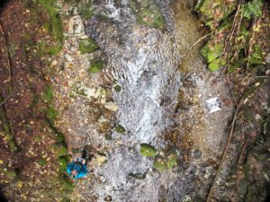
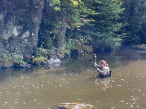
In Mavrovo National Park in North Macedonia, data were collected to carry out a minimum flow assessment. For this purpose, six gauging stations were installed to record seasonal flow variations in different river sections. In addition, six model reaches were surveyed in detail, providing the basis for the minimum flow assessment and the hydrological evaluation of the watercourses.
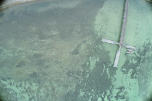
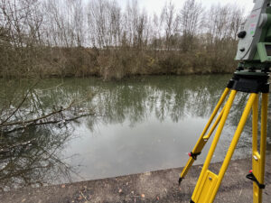
Drone survey of the shore of Lake Constance
Drone survey and creation of georeferenced orthomosaics of the Lake Constance shoreline for studies on sediment deposition.
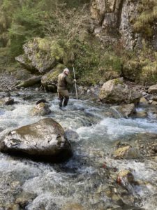
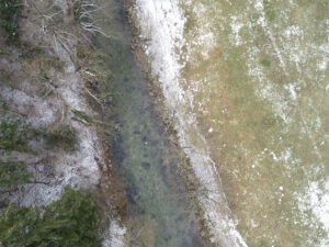
Survey of the river Stillach (Austria)
Survey of the Stillach River (Austria) using a drone, complemented by a terrestrial survey.
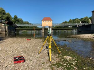
Survey of the River Isar (Austria)
Survey of the Isar River for the modeling of various flow scenarios
Aerial imagery for construction monitoring of the State Garden Show in Rottweil (Germany)
Drone flights and creation of georeferenced orthomosaics for construction monitoring of the State Garden Show in Rottweil.
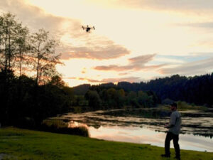
Aerial images for the assessment of the ecological status of rivers
On behalf of the Regional Council of Tübingen, we are currently conducting drone flights to generate aerial images for the State Study on Aquatic Ecology.
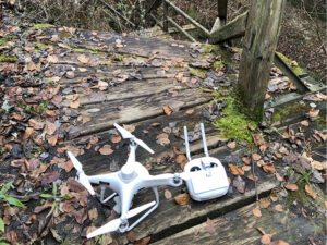
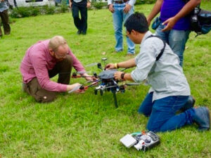
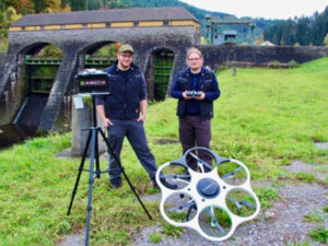
UAV training Speyer
Conducting a drone training in Speyer for a governmental agency on the topics of possibilities and limitations of drone surveys for ecological purposes, including a practical exercise
Lecture at the University of Stuttgart
Lecture at the University of Stuttgart: “Limnology and Ecohydraulic: Theory and Application”)
Training of Students and PhD Candidates in UAS-Based Water Remote Sensing in Ethiopia
Training of Students and PhD Candidates in UAS-Based Remote Sensing of Water within the Project ‘Sustainable Water Management Under Pressure in Ethiopia’ (SWAMP) as part of the DAAD Practice Partnerships between Universities and Companies in Germany and Developing Countries 2022-2025.
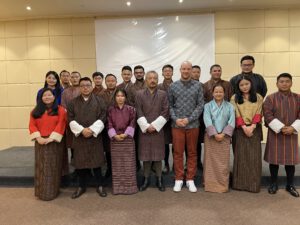
Testing and Training of Surveying Equipment in Bhutan as part of the E-Flow II Project
Testing of Existing Measurement Equipment and Hands-On Training for the Department of Water of the Ministry of Energy and Natural Resources in Bhutan.
Surveying of the Lindach River near Weilheim an der Teck
Surveying of the Lindach River near Weilheim an der Teck to provide data for a revitalization project.
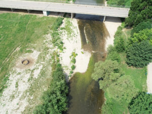
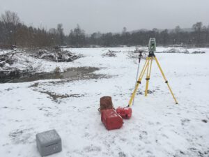
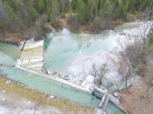
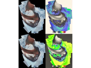
Estimation of the volume of sediment in the Neckar River near Rottweil
Estimation of the volume of sediment in the Neckar River near Rottweil using GPS, tachymeter, and sonar.
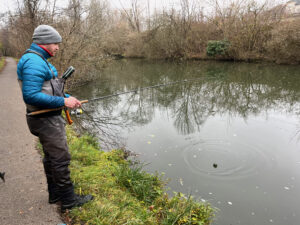
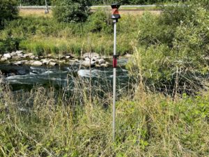
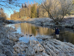
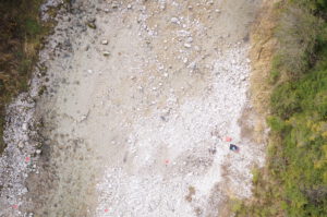
Survey of the Mindel River near Mindelheim for a minimum flow investigation
Surveying of the Mindel River near Mindelheim, Bavaria, for a minimum flow investigation
Survey at the Wahnbachtalsperre (reservoir)
Survey of the Wahnbach and Wendbach at the Wahnbachtalsperre (reservoir) as a basis for a flood model.
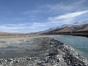
Surveying and Consulting within the Project: ‘Hydro4U: Hydropower For You – Sustainable Small-Scale Hydropower in Central Asia’
Hydro4U is a project funded under the European Union’s Horizon 2020 research and innovation program aimed at promoting sustainable small-scale hydropower in Central Asia.
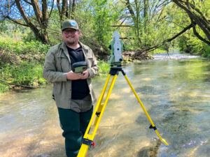
Survey of the Neckar near Aistaig
Survey at the Neckar near Aistaig as a data base for a revitalisation project
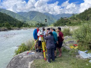
Hands-On Training in surveying water bodies in Bhutan
Hands-On Training on aquatic data collection in Bhutan. The training covered the use of tachymeters, GPS, UAS (Unmanned Aerial Systems), ADCP (Acoustic Doppler Current Profiler), and hand-held ADV (Acoustic Doppler Velocimeter)
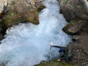
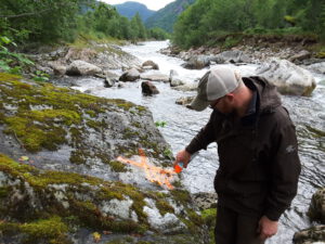
Survey at the Mamasa River
Abflussmessungen, Drohnenbefliegungen und GPS-Vermessungen am Mamasa-River auf Sulawesi für eine Mindestwasseruntersuchung im Rahmen des Bakaru II Hydropower Projects.
Field study Shohimardon
Feldstudie zur Untersuchung der Durchgängigkeit und Mindestwasserabgabe eines Kraftwerkneubaus in Shohimardon (Usbekistan) im Rahmen des EU-geförderten HYDRO4U-Projektes.
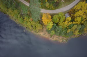
Sediment sampling and survey of gravel bars along the Danube
Sedimentprobenahme und Drohnenvermessung von sieben Kiesbänken der Donau bei Kelheim
Survey of Dijle
Survey of the Dijle River for the detectability and passability of a fish passage facility
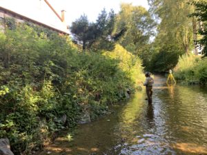
Survey of the Schussen
Surveying three sections of the Schussen River as part of a minimum flow investigation.
Survey of the Breg in Bräunlingen (Germany)
Survey of the Breg River in Bräunlingen as the basis for a report on minimum water conditions and passability in a diversion section on the Breg.
Survey of the Engelberger Aa
Survey of 4 kilometers of the Engelberger Aa as a data foundation for a habitat model for lake trout.

Lecture at the University of Stuttgart
Guest Lecture: “Drone-based Water Assessment: Introduction, Fundamentals, and Examples” in the field of Measurements, Monitoring, and Modeling (MMM).
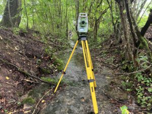
Data collection at the Nister
Data collection from two sections on the Nister as a basis for hydraulic and habitat modeling.
Surveying the Neckar
Survey of 2 kilometers of the Neckar River for a minimum flow investigation
Survey of the Neckar River in Tübingen (Germany)
Surveying areas of the Neckar River in Tübingen as a planning foundation for revitalization measures
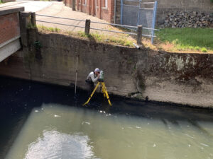
Elevation survey of the Basin bottom at the weir in Tübingen (Germany)
Location-specific elevation survey of the Tos Basin bottom at the weir in Tübingen as a planning foundation for the East Radbrücke (bike bridge)
Topographic Dam Survey at Simmerhammer
Topographic survey of the Simmerhammer and Heinzenberger Mühle weirs in Rhineland-Palatinate
Survey of the Lindach River near Weilheim Teck (Germany)
Projects Survey of the Lindach River near Weilheim Teck (Germany) Survey of flood hazard map cross-sections over 6 kilometers on the Lindach in the city
Survey at the River Bottwar (Germany)
Projects Survey of the Bottwar River (Germany) Survey of a weir area in the Bottwar near Kleinbottwar as a planning basis for the weir dismantling
Case Study for State Study on Aquatic Ecology (Baden-Württemberg): Aerial Inspection of Study Areas Using Drones
Projects Case study for the state study on aquatic ecology (Baden-Württemberg), aerial survey of the study areas using a UAS As part of the state
Drone-Based Survey of the “Marienschlucht” (Germany)
Projects Drone-based survey of the Marienschlucht (Germany) Drone-based survey of the Marienschlucht on Lake Constance as a planning basis for relocating the hiking trail Additional
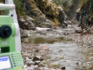
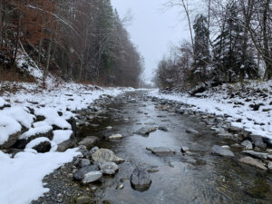
Survey Dürrach in Tyrol (Austria)
Projects Survey of the Dürrach in Tyrol (Austria) Survey, aerial survey, and flow measurements on the Dürrach at the border with Tyrol above the Sylvensteinspeicher
Installation of Oxygen and Multiparameter Probes on the Iller River
Projects Installation of Oxygen and Multiparameter Probes on the Iller River Installation of Oxygen and Multiparameter Probes on the Iller River as part of the
Lecture at the University of Stuttgart
Projects Lecture at the University of Stuttgart (Germany) Guest Lecture “Drone-Based Water Assessment: Introduction, Fundamentals, and Examples” in the field of Measuring, Monitoring, and Modeling
Survey of Cross-Sections for Flood Hazard Maps in Schiltach
Projects Surveying cross-sections for flood hazard mapping in Schiltach (Baden-Württemberg, Germany) Surveying of approximately 50 cross-sections for flood hazard mapping on the Schiltach river in
Survey Wiesent in Bavaria (Germany)
Projects Survey of the Wiesent River (Bavaria, Germany) Surveying, Aerial Surveys, and Flow Measurements on nine sections of the Wiesent River in the Franconian Switzerland
Survey Wiesent in Bavaria (Germany)
Projects Survey of the Wiesent (Bavaria, Germany) Surveying, Aerial Surveys, and Flow Measurements on nine sections of the Wiesent River in Franconian Switzerland as part
Survey of Wiesent Tributaries (Bavaria)
Projects Surveying of Wiesent River Tributaries (Bavaria, Germany) Surveying of several tributaries of the Wiesent River in Franconian Switzerland as part of a study to
Training in ‘Surveying and Structure from Motion (SfM)’ for the Bavarian State Fishery Association
Projects Training in ‘Surveying and Structure from Motion (SfM)’ for the Bavarian State Fishery Association Vermessung, Befliegung und Abflussmessungen an der Dürrach an der Grenze
Lecture at the University of Stuttgart
Projects Lecture at the University of Stuttgart (Germany) Guest lecture “Drone-Based Water Assessment: Introduction, Fundamentals, and Examples” in the field of Measuring, Monitoring, and Modeling
Lecture at the University of Stuttgart
Projects Lecture at the University of Stuttgart (Germany) Guest lecture “Drone-Based Water Assessment: Introduction, Fundamentals, and Examples” in the field of Measuring, Monitoring, and Modeling
Lecture at the University of Stuttgart
Projects Lecture at the University of Stuttgart (Germany) Guest lecture “Drone-Based Water Assessment: Introduction, Fundamentals, and Examples” in the field of Measuring, Monitoring, and Modeling
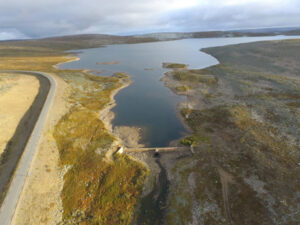
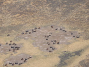
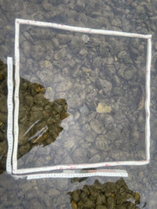
Mapping of Spawning Grounds in Finnmark, Norway
Projects Mapping of Spawning Areas in Finnmark (Norway) Bathymeric Investigation of the Minimum Flow Section and Mapping of Spawning Areas for Atlantic Salmon (Salmo salar)
Taigdalselva River, Western Norway – Bathymetric Survey
Projects Taigdalselva Westnorwegen – Bathymetric Survey Aerial survey of Taigdalselva in West Norway for the collection of bathymetry, water level lines, and the surrounding area
Aerial Survey of Three Flood Retention Basins, Digital Elevation Model (DEM) Creation, and Physical Modeling
Projects Aerial survey of three flood retention basins, digital elevation model (DEM) creation, and physical modeling. Aerial survey and creation of digital terrain models for
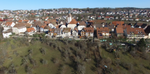
Aerial survey of the medieval City Center of Dornstetten (Germany)
Projects Aerial survey of the medieval town center of Dornstetten On the way to the virtual river: Comprehensive visualization of the ecosystem of flowing waters”
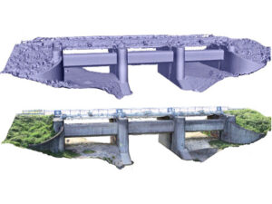
Aerial survey of the Dam Base of the “Schwarzenbachtalsperre” (Germany)
Projects Aerial Survey of the Dam Base of the Schwarzenbachtalsperre Aerial survey of the dam base of the Schwarzenbachtalsperre at full capacity to create a
Survey Jachen, Bavaria (Germany)
Projects Aerial survey of the River Jachen (Bavaria, Germany) Aerial survey of the Jachen River in Bavaria to create a high-resolution substrate map as part
Workshop on Integrating Drones in the Thai Water Management Sector
Projects Workshop on the Integration of Drones in the Thai Water Management Sector During the workshop on the integration of drones into the Thai water
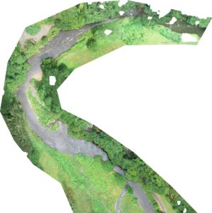
Soca, Slowenia
Projects Soca, Slowenia Aerial survey of multiple water bodies in the Soca River basin in Slovenia. Creation of digital terrain models and orthophotos. Additional References
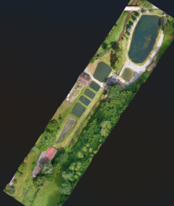
Aerial Survey of Multiple Areas at a Fish Farm (Germany)
Projects Aerial survey of multiple areas of a fish farm Aerial survey for the creation of a georeferenced, high-resolution orthophoto for the water rights approval
Aerial Survey Jachen (Germany)
Projects Aerial survey of the River Jachen (Bavaria, Germany) Aerial survey of the Jachen River in Bavaria for data collection for hydraulic modeling and the
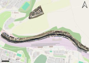
Aerial Survey of Litzauer Schleife on the Lech River in Bavaria (Germany)
Projects Aerial survey of the Litzauer Schleife on the Lech River in Bavaria (Germany) Aerial survey of several reference sections on the Lech River at
NDVI and RNVI
Projects NDVI and RNVI Determination of the NDVI (Normalized Difference Vegetation Index) and an RNVI (River Normalized Vegetation Index) based on the referencing of the
Survey of Murg in the Black Forest (Germany)
Projects Murg in the Black Forest Aerial Survey of Multiple Reference Sections along the Murg River in the Black Forest for High-Resolution Orthophoto Generation Additional